Our Location:
No. 99, Jiazi Road, Chengdu

 authorChris Lee
Your phone says you have arrived—but the street you need may be ten floors below you. That is normal in Chongqing. Here, bridges connect to rooftops, metro exits open onto different elevations, and a route that looks short on a map can hide hundreds of stairs.
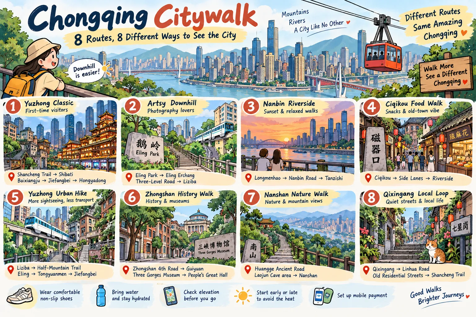
This guide compares eight practical Chongqing citywalks by time, terrain, scenery, crowds and trade-offs so you can choose the right walk before your legs make the decision for you.
Use this three-step rule: ① Find your priority in “Best For” → ② check distance and difficulty → ③ read that route's Trade-offs before starting.
| Route | Distance | Time | Difficulty | Best For | Key Stops | Typical Cost | Crowd Level |
|---|---|---|---|---|---|---|---|
| Route 1: Yuzhong Classic | 5–6 km | 5–8 hrs | Moderate | First-time visitors | Shancheng Trail, Shibati, Baixiangju, Jiefangbei, Hongyadong | Mostly free | High at major sights |
| Route 2: Artsy Downhill | ~3.5 km | 3–4 hrs | Easy–Moderate | Photography | Eling Park, Eling Erchang, Three-Level Road, Liziba | Mostly free | Low–Medium |
| Route 3: Nanbin Riverside | ~3.5 km | 3–4 hrs | Easy | Sunset, relaxed walks | Longmenhao, Nanbin Road, Tanzishi | Mostly free | Low–Medium |
| Route 4: Ciqikou Food Walk | ~2 km | 3–4 hrs | Easy | Food and old-town atmosphere | Ciqikou, side lanes, riverside | Free; food extra | High at peak times |
| Route 5: Yuzhong Urban Hike | ~5–6 km | 4–5 hrs | Moderate | Budget sightseeing | Liziba, Half-Mountain Trail, Eling, Tongyuanmen, Jiefangbei | Mostly free | Medium |
| Route 6: Zhongshan History Walk | ~4 km | 3+ hrs | Easy–Moderate | History and museums | Zhongshan 4th Road, Guiyuan, Three Gorges Museum | Mostly free | Low–Medium |
| Route 7: Nanshan Nature Walk | ~3–5 km | 3–4 hrs | Moderate | Nature, temples | Huangge Ancient Road, Laojun Cave area, Nanshan | Varies by site | Medium |
| Route 8: Qixingang Local Loop | ~2 km | ~2 hrs | Easy–Moderate | Quiet streets, local life | Qixingang, Linhua Road, Shancheng Trail section | Free | Low |
High temperature warning: Chongqing may still exceed 35°C in September. Route 1/4/5/7 recommends taking the route in the morning or evening.
One-line choice: Pick Route 1 for your first day, Route 2 for photos, Route 3 for sunset and Route 8 when you want Chongqing without the biggest crowds.
One important correction from older versions of this guide: Route 5 no longer tells you to “walk from Ciqikou to Liziba in 25 minutes.” Those areas are far apart, so that sequence was not realistic as a continuous citywalk. Ciqikou now remains its own Route 4, while Route 5 stays geographically focused around Liziba, Eling and central Yuzhong.
In Chongqing, the shortest line on a map is not always the easiest route.
Whenever the choice is reasonable, structure your walk from the higher point toward the lower point. This matters most on Eling–Liziba, Shancheng Trail and the steep lanes around central Yuzhong.
For Eling → Liziba, start high around Eling and descend toward Liziba. Going the opposite way turns a scenic walk into a much more demanding uphill climb.
The same logic applies around Qixingang and Shancheng Trail: check the elevation and the actual pedestrian entrance before blindly following the blue line in your navigation app.
Chongqing itself maintains an extensive network of mountain-city walking trails, including cliffside, riverside and forest routes; the city's official walking-trail network was designed specifically around its unusual terrain.
| What You Want | Suggested Start | Best Route |
|---|---|---|
| Classic sights + evening skyline | Around 14:00 | Route 1 |
| Late-afternoon photography | Around 15:00 | Route 2 |
| Sunset + river lights | Around 16:00 | Route 3 |
| Quieter Ciqikou streets | Morning or late afternoon | Route 4 |
| Longer urban walk | Morning | Route 5 |
| Museums + historical sites | Morning, Tue–Sun | Route 6 |
| Nanshan views | Morning on a clear day | Route 7 |
| Short quiet walk | Flexible | Route 8 |
These are planning suggestions, not attraction opening hours. Shop hours, museum hours, lighting times and site access can change seasonally or during holidays.
Do not assume September means fall weather in Chongqing.
On September 6, 2026, Chongqing's meteorological authorities issued an orange heat warning, with temperatures of 37–39°C forecast in low-elevation areas including Yuzhong, Shapingba and Nan'an.
That matters for Routes 1, 4, 5 and 7 in particular. During hot periods, shift longer walks toward morning or late afternoon, carry water and reduce exposed midday climbing.
The old blanket advice that “September onward means winter conditions” is not appropriate for Chongqing.
GPS is useful, but elevation is the problem.
A location pin may be geographically correct while the entrance you need sits several floors above or below you. When confused, asking whether somewhere is uphill or downhill is often more useful than asking whether it is north or south.
For navigation in China, TripChina's guide to navigation apps for foreign travelers explains why relying exclusively on Google Maps can cause problems.
Before leaving your hotel, also screenshot your hotel's Chinese name and address. If your mobile connection drops during a long walk, an offline screenshot is much easier to show a taxi driver or local resident.
For data access, see the China eSIM vs SIM Card guide.
Comfortable non-slip shoes matter more in Chongqing than almost anywhere else on a normal China city trip.
Take water, tissues, a charged phone and a small power bank. After rain, treat stone steps, polished paving and riverside surfaces cautiously.
If you expect to buy snacks, drinks or metro tickets during the walk, set up mobile payment beforehand. TripChina's How Foreigners Pay in China guide covers Alipay, WeChat Pay, cards and cash.
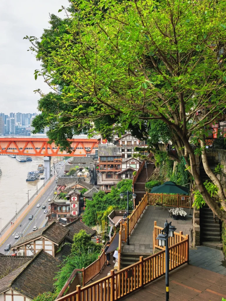
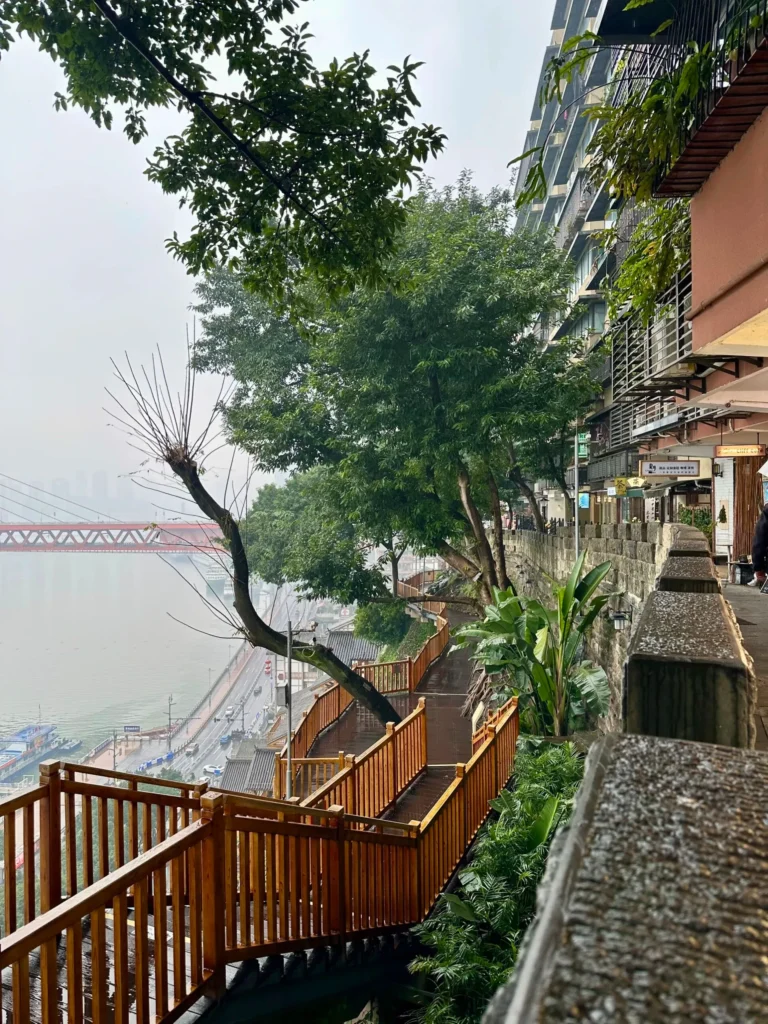
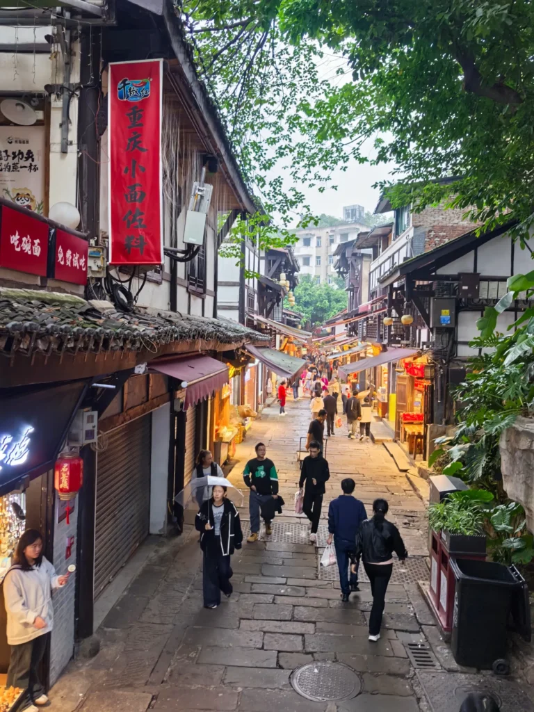
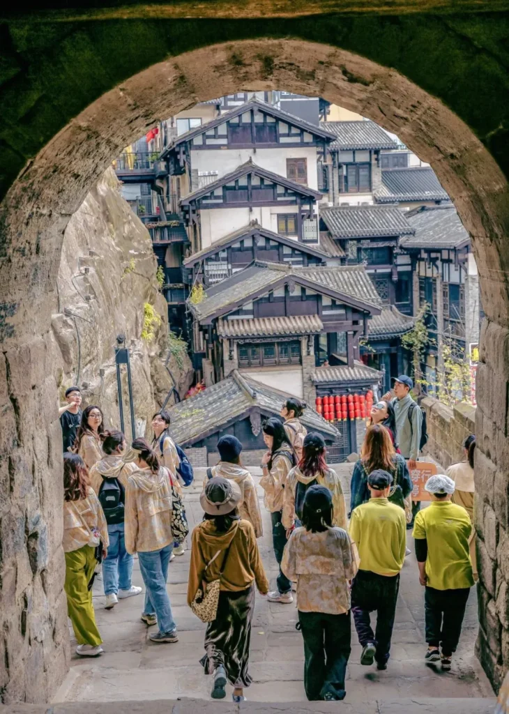
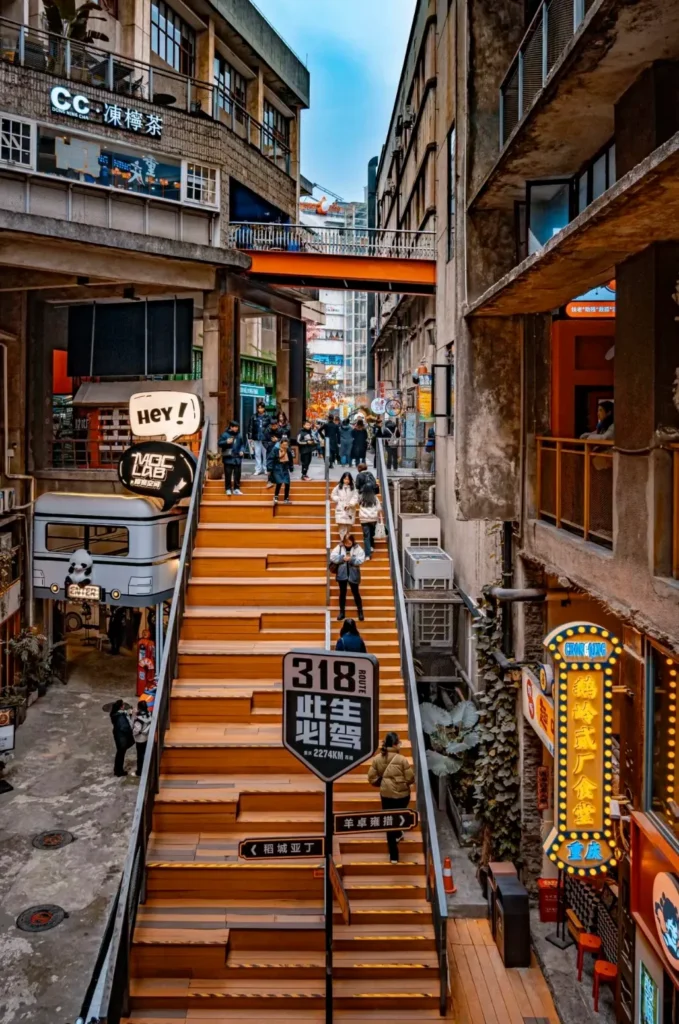
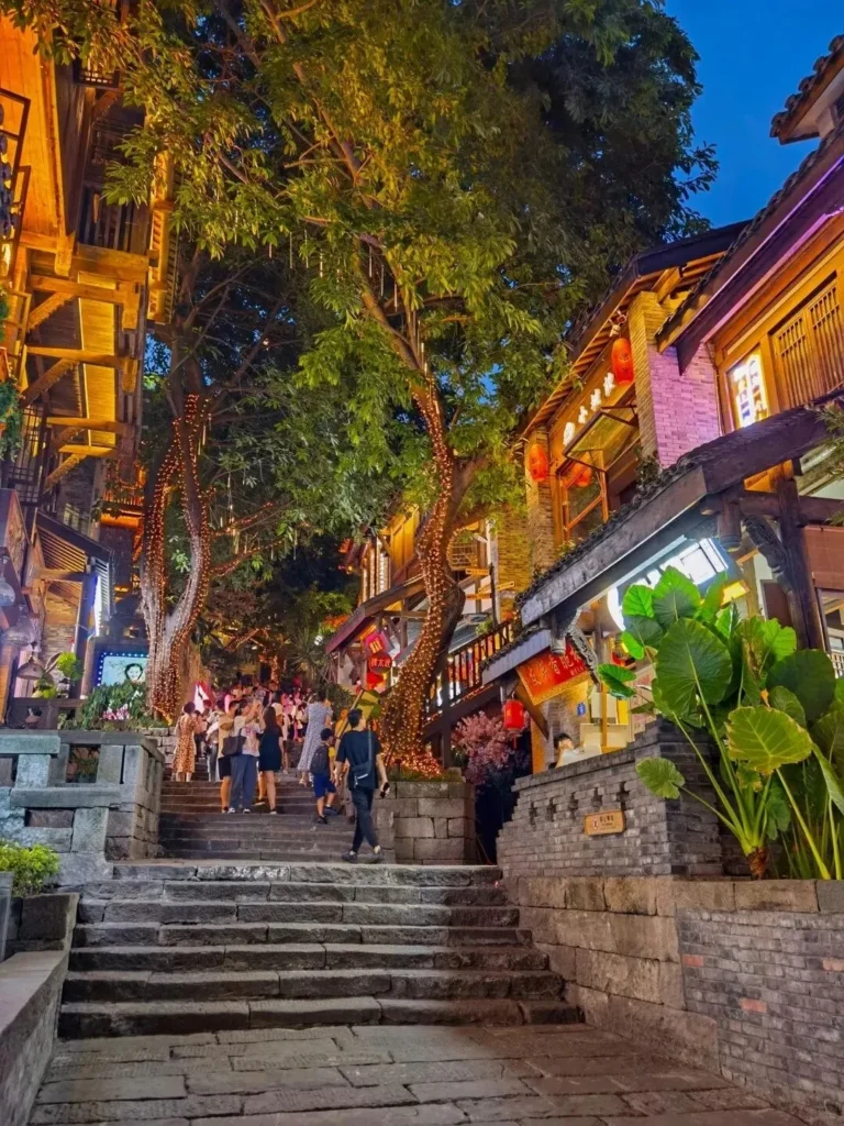
Distance: ~5–6 km
Time: 5–8 hours with stops
Difficulty: Moderate
Best For: First visits, landmark-heavy sightseeing
Best Start: Around 14:00 (⚠️ Avoid midday in extreme heat)
Route: Shancheng Trail → Shibati → Baixiangju area → Jiefangbei → Hongyadong
This is the route I would choose when someone tells me, “I only have one full day and I want Chongqing to actually feel like Chongqing.”
You move from old hillside paths into renovated traditional streets, then through dense residential architecture and finally into the neon-heavy commercial center.
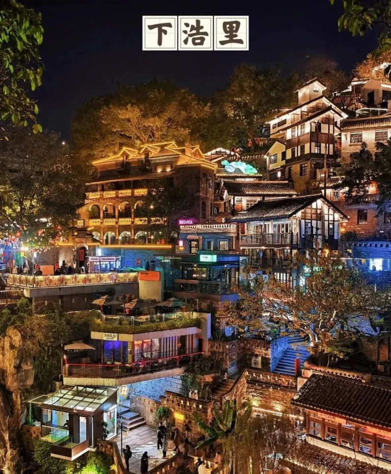
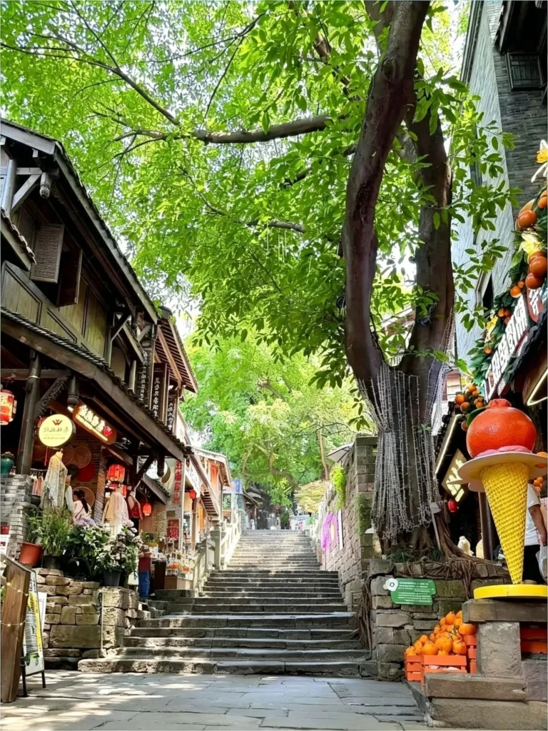
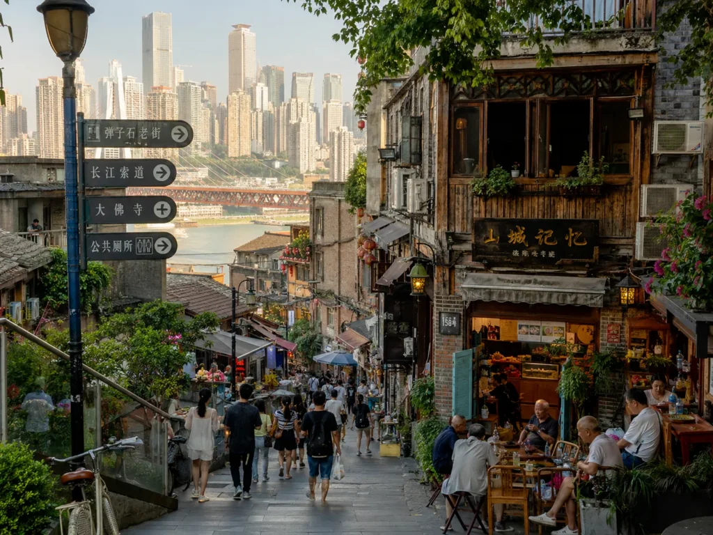
Shancheng Trail gives you the cliffside relationship between Chongqing and the Yangtze. Shibati shows a more polished version of the old mountain-city street pattern. Baixiangju gives you one of the clearest examples of how buildings, streets and elevation overlap here.
If Shibati is a major part of your trip rather than just a stop on this route, TripChina's Chongqing Shibati Guide goes into the entrances, route and timing in more detail.
Finish around Jiefangbei and Hongyadong after dark rather than trying to start there.
Trade-offs: This route gives you the widest landmark coverage but also the most tourists. You sacrifice the relaxed atmosphere of Nanbin Road and the photography focus of Route 2. On extremely hot days, 5–8 hours is too ambitious unless you build in long indoor breaks.
Distance: ~3.5 km
Time: 3–4 hours
Difficulty: Easy to Moderate when walked downhill
Best For: Photography, layered city views
Best Start: Mid-to-late afternoon
Route: Eling Park → Eling Erchang → Three-Level Road area → Liziba
The direction matters: Eling first, Liziba last.
Start high and gradually work your way downhill. Reversing it means considerably more climbing and turns an otherwise manageable walk into something much harder.
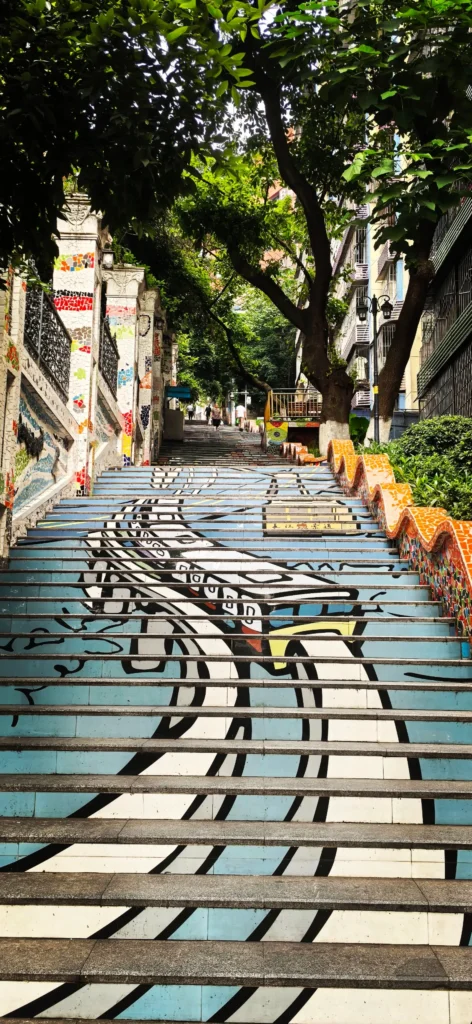
Eling gives you elevated city views; Eling Erchang adds industrial architecture and creative-space visuals; the descent toward Liziba reveals the layered residential roads that make Chongqing so photogenic.
Liziba is the obvious finish because you can then watch Line 2 pass through the building before continuing elsewhere by metro.
Do not become obsessed with finding one “secret exact photo pin.” Construction, barriers and crowd-control arrangements around popular viewpoints can change. Use the route for the layered streets themselves, not only one Instagram frame.
Trade-offs: Excellent for photos, weaker for old-neighborhood history. Eling Erchang is a redeveloped creative district rather than preserved everyday old Chongqing.
Distance: ~3.5 km
Time: 3–4 hours
Difficulty: Easy overall
Best For: Sunset, couples, relaxed walking
Best Start: Around 16:00
Route: Longmenhao Old Street → Nanbin Road → Tanzishi area
This is the route for the traveler who looks at Chongqing's staircases and thinks, “Not today.”
Nanbin Road follows the south bank of the Yangtze and gives you long views back toward Yuzhong's skyline. Pairing it with Longmenhao and Tanzishi adds enough old-street texture that the route does not feel like a generic riverside promenade.
Start in late afternoon, walk through the transition into sunset, and let the city lights come on across the river.
The Nan'an District government continues to promote multiple citywalk routes around Longmenhao, Nanshan and the southern-bank walking network in 2026, reinforcing the area as one of Chongqing's main walking zones.
Trade-offs: Much gentler than Yuzhong, but you lose much of the classic stair-heavy “8D” experience. Rain and wet riverside paving can also make an otherwise easy walk slippery.
Distance: ~2 km inside the core walking area
Time: 3–4 hours
Difficulty: Easy
Best For: Snacks, old-town atmosphere
Best Start: Morning or late afternoon
Route: Main entrance → old streets → side lanes → riverside / back-street area
Ciqikou works best when you stop treating the main commercial street as the whole attraction.
The central lane is crowded, commercial and snack-heavy. Step into the smaller lanes and the atmosphere changes quickly.
Ciqikou remains one of Chongqing's major historic districts, and the official 2026 city profile highlights its traditional urban fabric, riverside setting and expanded back-street area.
Go early if you want stone streets before the largest tour groups arrive. Late afternoon is the better compromise if food and evening atmosphere matter more.
Always check a price before accepting snacks sold by weight. “Cheap per unit” signs can become surprisingly expensive once a full bag is weighed.
For a full route rather than just this abbreviated citywalk, use TripChina's Ciqikou Ancient Town Guide.
Trade-offs: Ciqikou is a destination walk rather than a cross-city Chongqing experience. It gives you traditional streets and food but not the dramatic central skyline or Liziba architecture.
Distance: ~5–6 km, depending on detours
Time: 4–5 hours
Difficulty: Moderate
Best For: Budget travelers, strong walkers
Best Start: Morning
Route: Liziba → Half-Mountain / cliffside walking sections → Eling → Tongyuanmen area → Jiefangbei
This is the efficient urban-hike option.
Unlike older versions of this route, it does not begin at Ciqikou. Ciqikou and Liziba are too far apart to sensibly treat them as adjacent walking stops.
Start around Liziba and climb or connect into the nearby hillside walking network, then work toward Eling and central Yuzhong. From there, continue east through older city-wall areas toward Jiefangbei.
Chongqing's official mountain-trail network includes the Half-Mountain Cliff Trail among its established central-city walking routes.
The point of Route 5 is not to “collect seven free attractions” as quickly as possible. It is to experience how the city connects vertically while keeping transport costs low.
Trade-offs: This is the most navigation-sensitive route. Exact pedestrian connections can be altered by construction, gated residential areas or trail maintenance. If your map starts sending you onto a car road or into a closed access point, do not force the route—reroute or take one short metro/taxi connection.
Distance: ~4 km
Time: 3+ hours
Difficulty: Easy–Moderate
Best For: Modern history, architecture, museums
Best Start: Morning, Tuesday–Sunday
Route: Liziba / Niujiaotuo area → Zhongshan 4th Road → Guiyuan / historic sites → Three Gorges Museum → People's Great Hall exterior
This route has less “viral Chongqing” and more actual historical context.
Zhongshan 4th Road and the surrounding area contain Republican-era and wartime historical sites, shaded streets and government-era architecture. It is a much calmer counterpoint to Hongyadong.
The biggest 2026 update concerns the Chongqing China Three Gorges Museum. Older versions of this article said advance reservations were required. That is now outdated.
Since October 1, 2025, the museum's main building has operated without advance reservation; visitors can enter with a valid identity document, subject to real-time crowd-control measures. The museum remains free, and its current official opening hours are 9:00–17:00, closed Mondays except statutory holidays.
Foreign visitors should carry their passport rather than assuming a screenshot will be accepted as an identity document.
Trade-offs: Less dramatic terrain and fewer skyline views. Monday closures affect the museum and several cultural venues, so this is not the route I would schedule for Monday.
Distance: Roughly 3–5 km depending on the section chosen
Time: 3–4 hours
Difficulty: Moderate
Best For: Nature, temples, mountain scenery
Best Start: Morning, preferably with clear visibility
A practical sequence is:
Huangge Ancient Road → Laojun Cave area → continue toward a suitable Nanshan viewpoint or Huangjueya
Do not treat every Nanshan trail you see online as one continuous mandatory path.
The Nan'an District government's own 2026 citywalk recommendations include a half-day route beginning at Huangge Ancient Road and passing Laojun Cave, confirming this as an established walking combination.
Huangge Ancient Road itself has roughly 800 years of history and was once part of an important Sichuan–Guizhou trade route.
For Laojun Cave, confirm the current admission policy on-site, as access arrangements for temples can change. Individual religious sites and associated areas can change access arrangements.
Do this route on a clear day. Fog, haze or heavy rain can remove much of the reason for climbing to panoramic viewpoints.
Trade-offs: More physical effort, fewer famous urban landmarks and a larger weather dependency than the other routes.
Distance: ~2 km
Time: ~2 hours
Difficulty: Easy–Moderate
Best For: Quiet streets, local atmosphere
Best Start: Flexible
Route: Qixingang → Linhua Road / surrounding lanes → old residential streets → connect toward a Shancheng Trail section
Route 8 is deliberately less spectacular.
That is the point.
You trade the “I saw Hongyadong” checklist for hillside alleys, residential buildings, small street corners and sections of old Chongqing that are easier to notice when nobody is pushing behind you with a selfie stick.
Start around Qixingang and keep your route generally downhill toward the older lower streets rather than turning the walk into an unnecessary climb.
Some specific photo spots popular on Chinese social media change quickly because of construction or residential access. Respect private buildings and do not enter apartment corridors simply because a viral post marked them as a photo location.
Trade-offs: Few blockbuster landmarks. This route is best after you have already seen Jiefangbei, Hongyadong or Liziba—or if those places are exactly what you want to avoid.
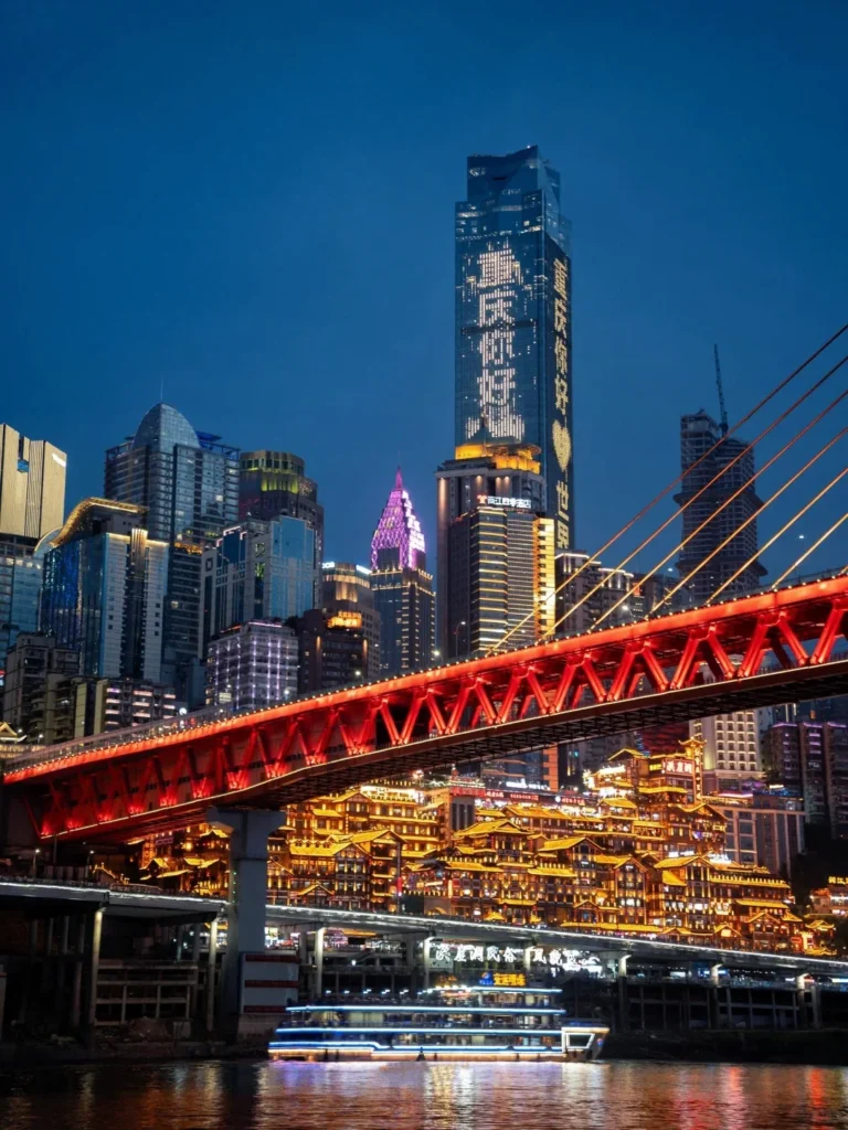
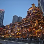
Hongyadong is free to view from outside and is best understood as a night skyline stop, not something you need to spend hours inside.
Older official visitor notices have required free advance reservations through Hongyadong's official WeChat channel. Because entry controls can change during holidays and peak periods, check the official Hongyadong WeChat account or current on-site instructions rather than relying on an old screenshot.
Lighting times also change. The latest specific Chongqing government notice I could verify set the exterior lighting at 18:30–23:00, but that notice dates from February 2025, so treat it as background—not a guaranteed September 2026 schedule.
For photos, Qiansimen Bridge and the opposite/outside approaches are often more useful than fighting through the interior.
For a broader comparison of night viewpoints, see TripChina's Chongqing Night View Guide.
| Situation | Why It Can Be a Problem | Better Approach |
|---|---|---|
| Paid “shortcut” or “fast-track” offers around free attractions | You may simply be led to a normal public entrance or elevator | Follow official signs and staff |
| “Free” gifts, fortune telling or unsolicited photos | Payment may be requested afterward | Ask the price first or decline |
| Pre-cut fruit sold by weight | Final cost may be much higher than expected | Confirm price and weight before buying |
| Unsolicited tour / cruise sellers | Product and price can be unclear | Buy through official counters or established platforms |
| Taxi or street recommendations you did not request | You may be taken somewhere chosen for commission rather than quality | Choose the restaurant or attraction yourself |
Chongqing's own tourism guidance has warned visitors not to trust people charging for unofficial guidance around Hongyadong and to purchase tourism products through正规/official sales channels.
For a broader first-trip checklist, TripChina's Chongqing Travel Mistakes Guide covers transport, tourist traps and planning errors beyond citywalks.
For more Chengdu travel tips, visit our Chongqing Travel Guide Hub.
Choose Route 3, Nanbin Riverside, first. It is the easiest of these eight to adapt into a mostly level riverside walk. Route 6 is another relatively manageable choice, but individual connections around Niujiaotuo and museum areas can still involve slopes, so use elevators or metro connections when needed.
Central Chongqing is heavily trafficked well into the evening, but normal urban precautions still apply. Stick to lit public routes, keep valuables controlled in dense crowds, avoid isolated mountain trails late at night and do not follow strangers offering unsolicited services.
Prioritize grippy walking shoes rather than fashionable flat-soled footwear. Clothing depends on the actual forecast, not the month: even early September can remain extremely hot, while winter is often damp and chilly rather than northern-China cold. Check the weather on the morning of any long route.
Treat it as an outside-view stop, not the centerpiece of your walk. Approach after the main dinner rush, photograph it from an exterior viewpoint such as the Qiansimen Bridge side, and leave yourself flexibility because crowd-control measures can change on busy evenings.
There is no single winner. Nanbin Road and parts of the Tanzishi/Longmenhao waterfront give excellent free skyline views, while Eling offers higher city perspectives. If visibility is poor, do not climb Nanshan solely for the panorama—river-level viewpoints may give you a better result with far less effort.
Screenshot this section before you go.
| You Want | Choose | Start | Remember |
|---|---|---|---|
| First trip, classic Chongqing | Route 1 | ~14:00 | Finish around Jiefangbei / Hongyadong after dark |
| Photography | Route 2 | Afternoon | Go Eling → Liziba, not the harder reverse |
| Sunset + easy walking | Route 3 | ~16:00 | Riverside surfaces can be slippery after rain |
| Food + old town | Route 4 | Morning / late afternoon | Leave the main street and explore side lanes |
| Maximum walking / low transport spend | Route 5 | Morning | Stay within Yuzhong; Ciqikou is not next door |
| History + museums | Route 6 | Morning | Avoid Monday; Three Gorges Museum no longer requires advance reservation |
| Nature + temple atmosphere | Route 7 | Morning | Go when visibility is good |
| Quiet local streets | Route 8 | Flexible | Follow the terrain downhill and respect residential access |
Direction worth remembering: Eling → Liziba is the easier orientation.
Emergency numbers: Police 110 · Medical emergency 120
Tourism complaints / consultation in Chongqing: 023-12345. Chongqing's Culture and Tourism Development Commission currently lists this number as its tourism complaint and consultation hotline.
For a first visit, Route 1 remains the strongest all-round introduction because it connects the terrain, old streets, central skyline and famous night scenery in one day.
Route 2 is better if photography matters more than landmarks. Route 3 is the clear choice when you want sunset without punishing your knees. Route 6 gives the trip more historical depth, while Route 8 works when you are tired of standing wherever everyone else on Xiaohongshu is standing.
The bigger lesson is simple:
In Chongqing, do not choose a route only by distance. Choose it by elevation, direction and what your legs will still want to do three hours later.
Chongqing Emergency Management Bureau — September 6, 2026 High-Temperature Warning
Chongqing Municipal Government — Hongyadong Lighting-Time Notice
Chongqing China Three Gorges Museum — Notice Ending Advance Reservations
Chongqing Culture and Tourism Development Commission — Contact & Tourism Complaint Hotline
Last reviewed September 6, 2026. This guide compares the original TripChina route framework with updated Chongqing government, district tourism and attraction information. I rechecked current heat conditions, Hongyadong guidance, mountain-city walking routes and Three Gorges Museum entry rules. Route distances and walking times remain planning estimates because Chongqing's elevation, construction, entrances and detours can materially change a walk. Attraction access, lighting schedules and religious-site admission policies should be reconfirmed shortly before visiting. During China's major national holidays, expect significantly higher crowds and longer wait times across all routes.
TripChina.me creates practical China travel guides shaped by real local experience, helping independent travelers navigate transport, payments, food, neighborhoods, and the cultural details that make traveling in China easier and more meaningful. Find the guide for your destination at tripchina.me.